Municipal governments
Local risk studies, urban-planning support and prioritization of critical zones.
Scientific briefings, research collaboration, seismic risk studies, technical training and engineering-oriented applications.
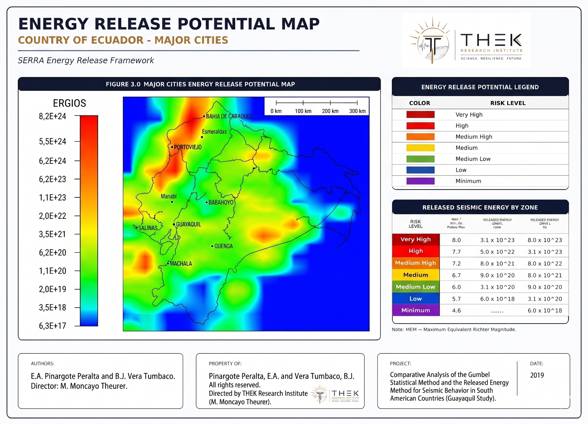
Local risk studies, urban-planning support and prioritization of critical zones.
Country-scale mapping, reactivation monitoring and complementary hazard assessment.
Risk screening for strategic facilities and assets.
Technical interpretation of seismic risk parameters for projects.
Research collaboration, theses, workshops, datasets and seminars.
Energy-based regional comparison and exposure prioritization.
The historical seismic platform provides a fast way to understand how SERRA can evolve from a scientific framework into an operational visualization environment.
For collaboration, training, consulting, institutional studies or conference invitations.