Municipal governments
Local seismic risk studies, urban planning support, critical zones and emergency-preparedness prioritization.
THEK Research Institute offers explanatory meetings, research collaborations, seismic risk studies, technical courses, workshops and conferences based on the SERRA/MEL framework.
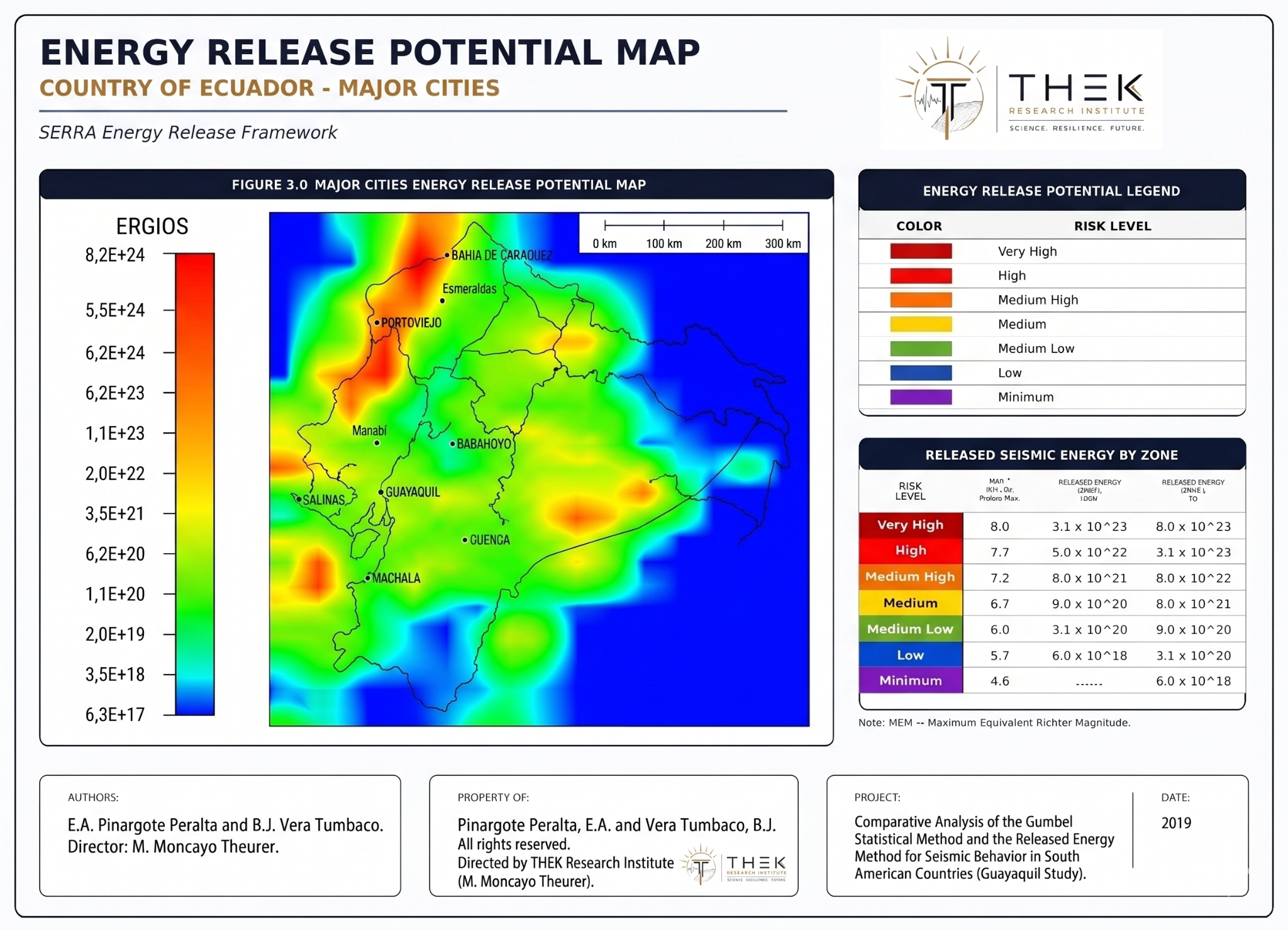
Local seismic risk studies, urban planning support, critical zones and emergency-preparedness prioritization.
Country-scale risk mapping, reactivation monitoring and complementary seismic hazard assessment.
Risk screening for ports, bridges, hospitals, schools, industrial facilities and strategic assets.
Technical support for seismic design assumptions, expected magnitude, PGA and site-risk interpretation.
Research collaboration, thesis lines, workshops, datasets, seminars and scientific development of SERRA.
Energy-based catastrophe risk interpretation, regional comparison and exposure prioritization.
The framework can be presented or applied at different levels depending on the institution’s needs, from a strategic conference to a technical municipal study.
A 60–90 minute presentation for decision-makers explaining the method, validation, risks and possible uses.
Training on energy release curves, SIGSA, seismic catalogs, risk maps and methodological interpretation.
Preliminary SERRA-based assessment for a city or canton, including sources, energy behavior and risk priorities.
Framework application to a facility or strategic asset requiring seismic risk interpretation.
Development of papers, datasets, maps, validation studies and new SERRA computational tools.
Energy-based seismic risk mapping at national, regional or multi-country scale.
The current THEK prototype demonstrates the direction of SERRA as a living monitoring and visualization system, not only as a static publication.
The best first step is a short explanatory meeting where THEK presents the method, the validation evidence, the available data, and the type of study or collaboration that fits the institution.
| Need | Recommended action |
|---|---|
| Understand the method | Executive SERRA briefing. |
| Evaluate city risk | Municipal seismic risk screening. |
| Train technical staff | Course or workshop. |
| Develop a paper | Research collaboration. |
| Assess infrastructure | Project-specific SERRA application. |
For collaborations, courses, consulting projects, institutional studies, technical demonstrations or conference invitations.
Email: ntndecuador@gmail.com